|
Amador County
News and Information from Amador County

|
| Announcements |
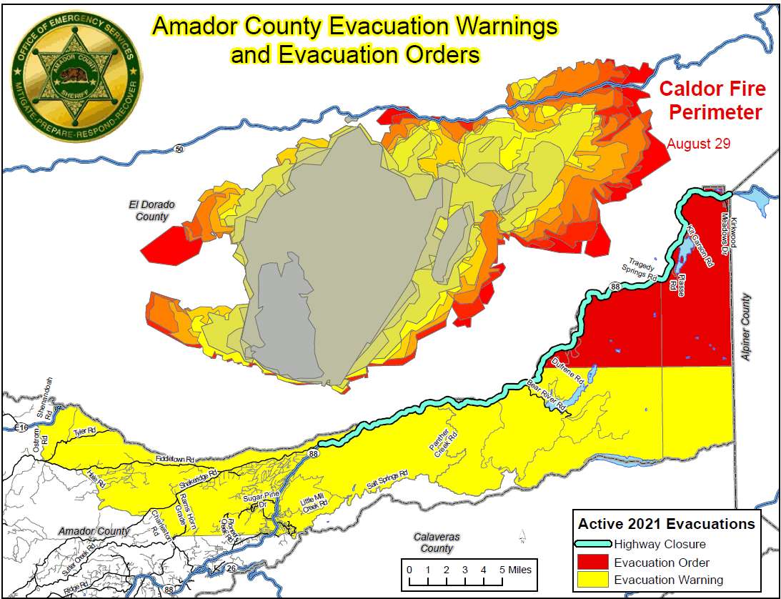
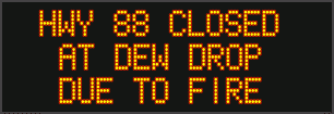
Highway 88 is Closed Between Omo Ranch Rd. & Highway 88/89 Interchange Due to Caldor Fire |
|
Posted by: thepinetree on 08/29/2021 05:11 PM
|
Grizzly Flats, CA...Highway 88 is closed between Omo Ranch Rd. and the Highway 88/89 interchange. Evacuation Order: Amador County South of Highway 88 along the Amador/El Dorado County line from Dufrene Road, due east to the Amador/Alpine County line and from the Amador/Alpine County line north to Hwy 88.
  |
|
Read More
| 9 Comments
|
|
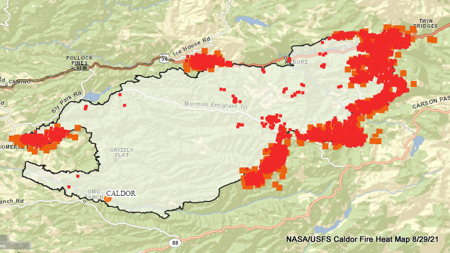
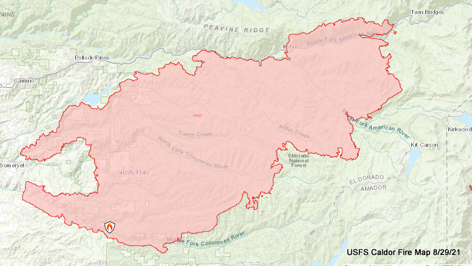
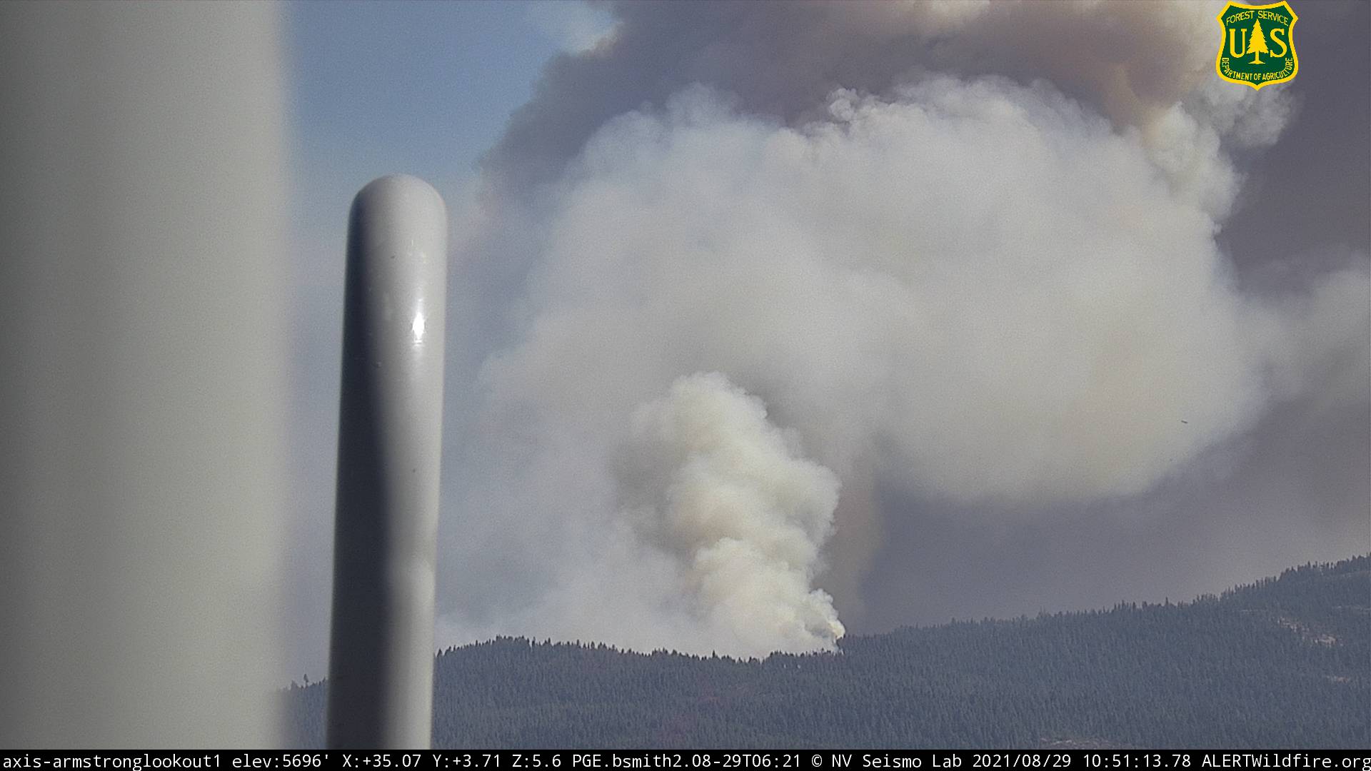
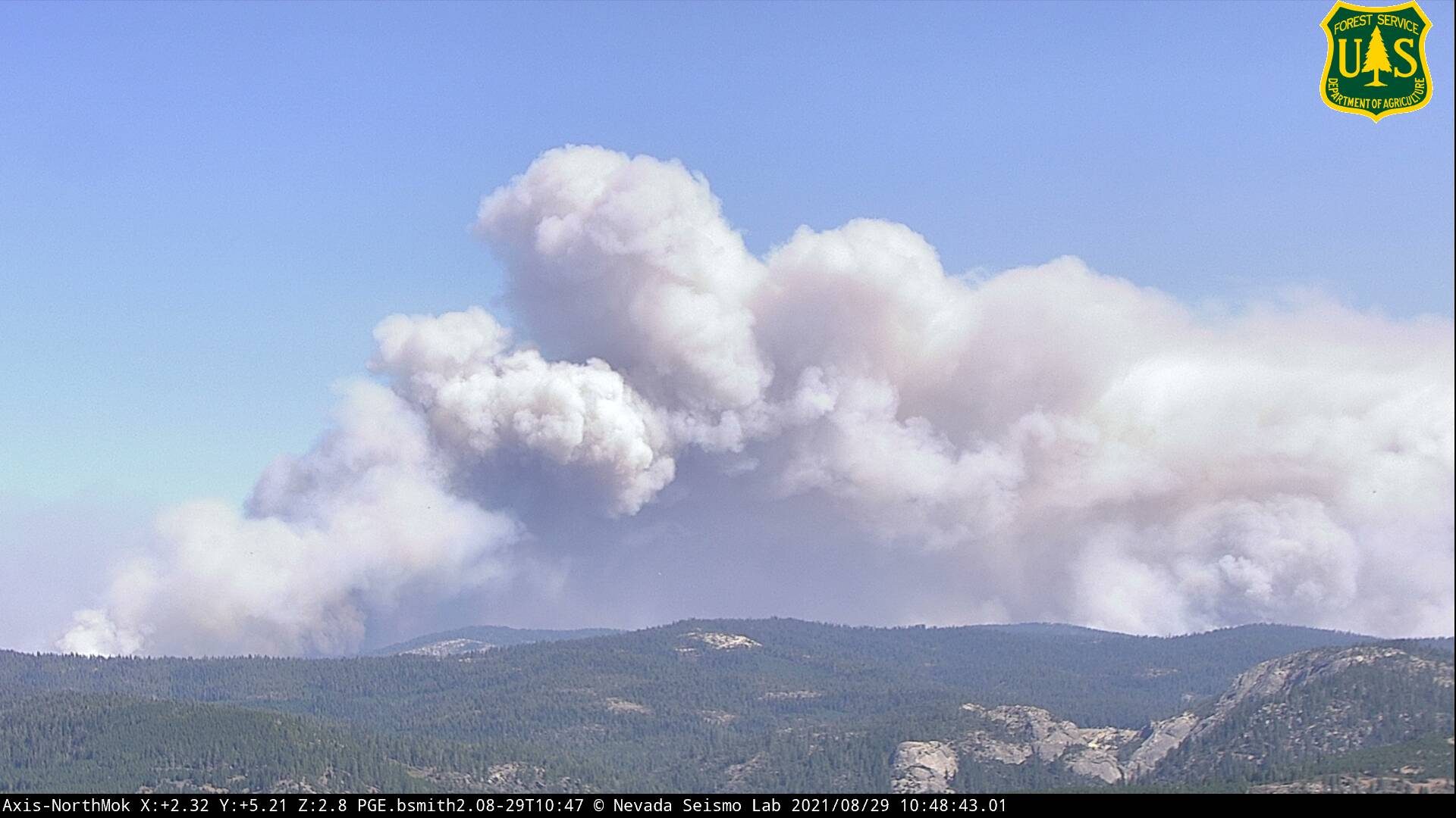
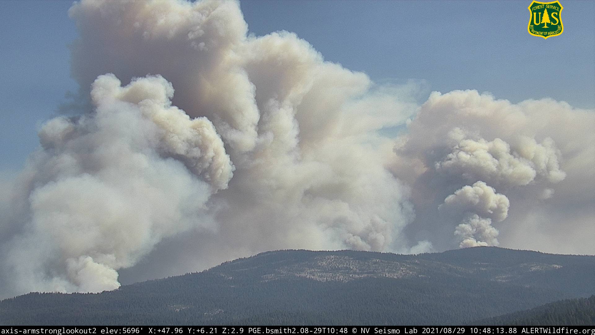
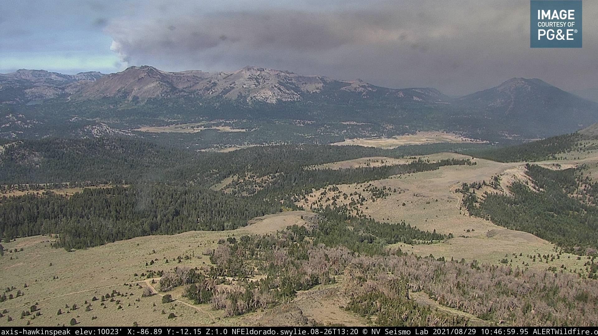
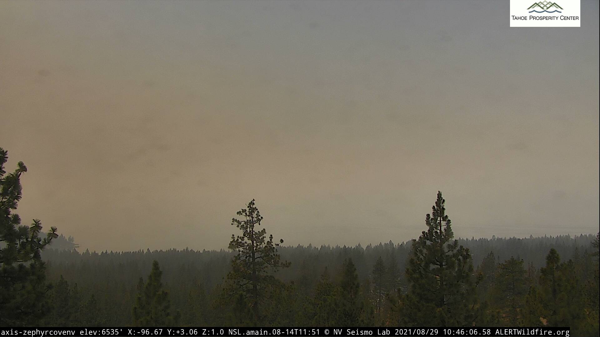
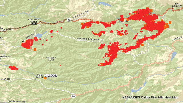
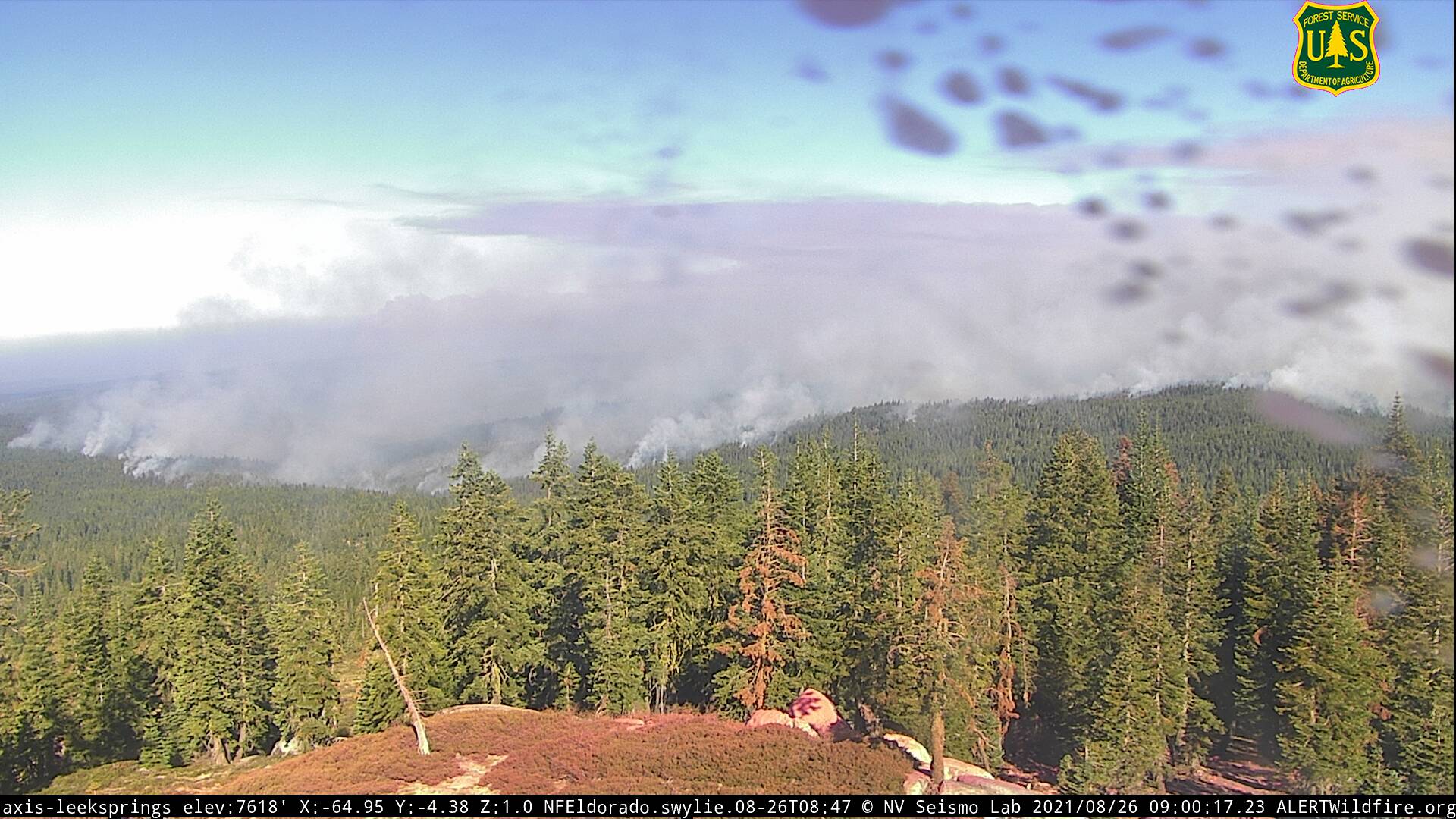
Caldor Fire Now 156,515 Acres, Heat Maps Reach Twin Bridges & Edging Closer to Kirkwood Area |
|
Posted by: thepinetree on 08/29/2021 11:00 AM
|
Grizzly Flats, CA...Fire activity was limited overnight due to the inversion layer settling in, these fire conditions allowed crews to engage the fire directly. Short-range spotting and group touching continue with the most active fire activity present in the Northeast and Western sections of the fire. Steep terrain, ash pits, and fire weakened trees continue to pose a threat for fire crews throughout the fire.
       |
|
Read More
| 9 Comments
|
|
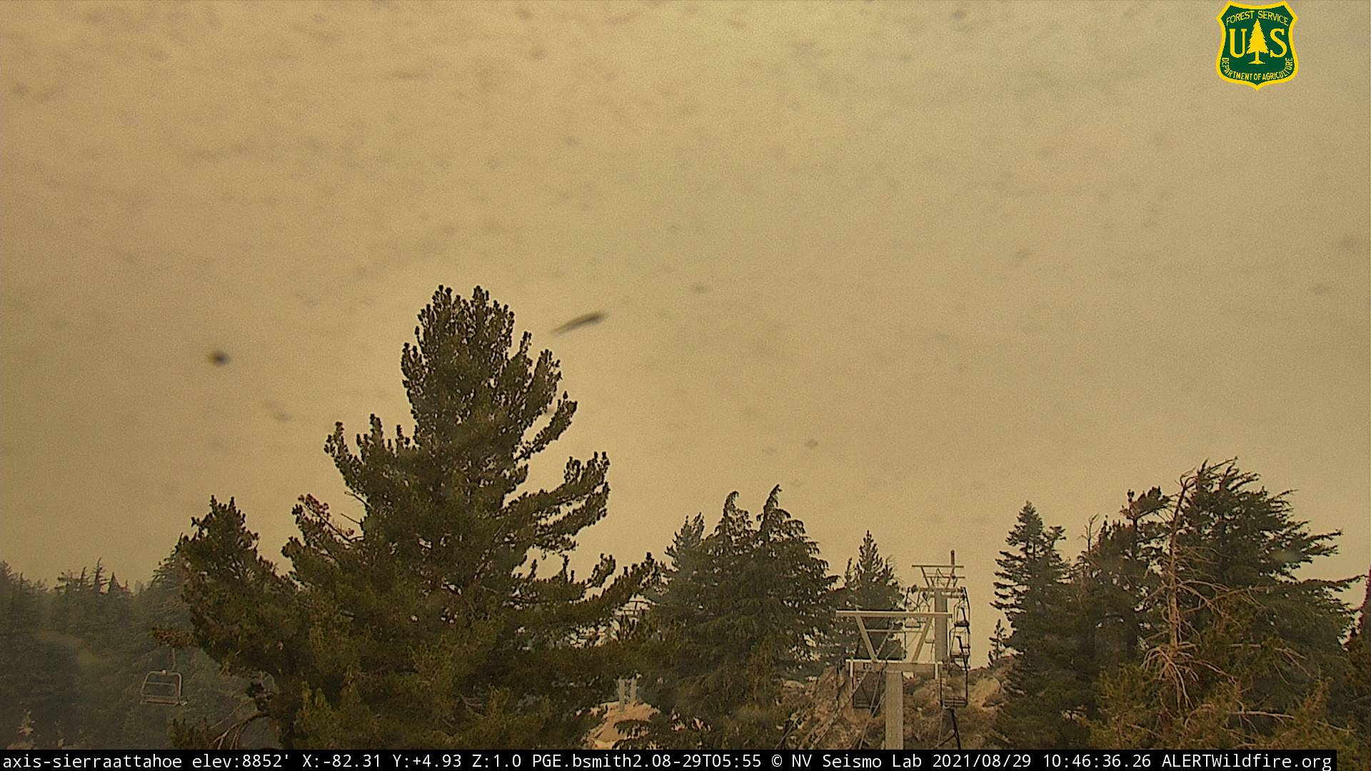
Caldor Fire Burns to 152,545 Acres, 19% Contained, 652 Structures Burned & 4 Injuries |
|
Posted by: thepinetree on 08/28/2021 08:29 PM
|
Grizzzly Flats, CA...The overnight inversion layer was present until 2:00 p.m. which decreased fire spread, spotting, and visibility well into today’s firefighting operations. As the inversion lifted erratic winds and low humidity increased fire activity with ember casts of up to half a mile. Steep terrain, ash pits and fire weakened trees continue to pose a threat for fire crews throughout the fire. Damage inspection teams continue to inspect properties and infrastructure throughout the area.
|
|
Read More
| 1 Comments
|
|
Traffic Update....Vehicle vs Fence Near 5724 Park Circle |
|
Posted by: thepinetree on 08/28/2021 07:46 PM
|
Buena Vista, CA...Traffic Update....Vehicle vs Fence Near 5724 Park Circle. Not sure what the fence did wrong....

 |
|
Read More
| 0 Comments
|
|
Update to Caldor Fire's Eldorado County Evacuation Orders, Warnings, and Road Closures |
|
Posted by: thepinetree on 08/27/2021 08:37 PM
|
Grizzly Flats, CA...Update to Evacuation Orders, Warnings, and Road Closures. Effective Immediately, El Dorado County Evacuation Routes: Residents evacuating the area should exit Westbound on Pleasant Valley Road or Northwest on Bucks Bar Road. Evacuation Order: El Dorado County Pleasant Valley Road and all intersecting roads extending south from Newtown Road to the intersection of E-16 (Mt Aukum Road). All roads accessed from E-16 (Mt Aukum Road) between Pleasant Valley Road and Bucks Bar Road. This includes all roads and residences accessed from Moon-Shadow and Gopher Hole Road off Bucks Bar Road.
 |
|
Read More
| 1 Comments
|
|
Stolen Toyota Corolla Recovered by Jackson Police |
|
Posted by: News_Desk on 08/27/2021 12:59 PM
|
Jackson, CA...On 08/18/2021 at approximately 1933 hours, the Jackson Police Department was dispatched to the area of Jackson Gate Road/Teresa's, to a reported theft of motor vehicle that just occurred. The responding Sergeant was flagged down by a female, Gina and front passenger Leland Ruddock. Leland reported he was outside of his vehicle talking to a friend in the 1300 block of Jackson Gate Road, when an unknown person drove off in his green 2009 Toyota Corolla without his permission. Leland advised the vehicle was last seen traveling south on Jackson Gate Road and it was believed to be followed by a white small SUV (NFD).

|
|
Read More
| 0 Comments
|
|
Foothill Conservancy Welcomes New Executive Director |
|
Posted by: News_Desk on 08/27/2021 12:49 PM
|
Jackson, CA...Megan Fiske has been named the Foothill Conservancy's new executive director, effective immediately. She brings with her over a decade’s experience working in the Sierra Nevada with both environmental nonprofits and the U.S. Forest Servic

|
|
Read More
| 1 Comments
|
|
Mokelumne River Cleanup on September 18th! |
|
Posted by: News_Desk on 08/27/2021 12:45 PM
|
Amador County, CA...Foothill Conservancy invites everyone to join in the 2021 Mokelumne River Cleanup on Saturday, September 18, from 9 a.m. until noon. The event will focus on the Mokelumne Electra Run south of Jackson, the most popular section of the river. The annual, family-friendly event gives people an opportunity to protect the Mokelumne’s water quality and clean up recreational sites while enjoying a beautiful morning along California’s 15th state wild and scenic river. Click 'Read More' below for more details.

|
|
Read More
| 0 Comments
|
|
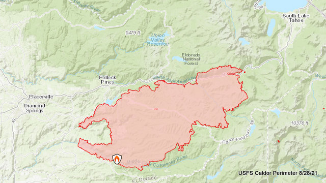
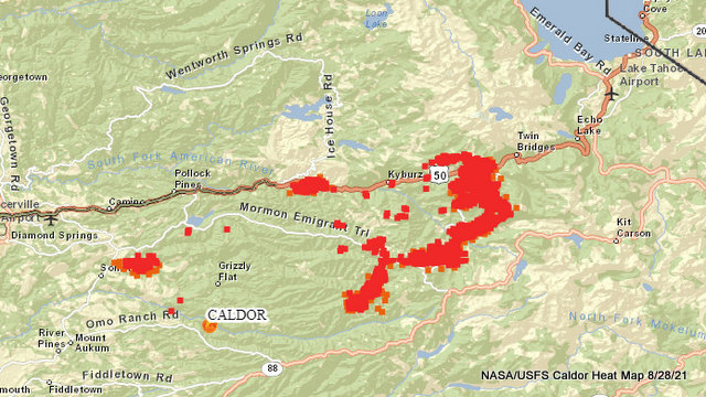
Caldor Fire Update, 136,643 Acres, 12% Contained, 637 Structures Burned, 2,897 Personnel |
|
Posted by: thepinetree on 08/26/2021 10:29 AM
|
Grizzly Flat, CA...Throughout the evening hours and overnight, the fire remained active in the Northeast with most growth occurring in Divisions I and J. Critical fuel conditions, steep and rugged terrain still present a challenge for crews. Firefighters are continuing with the firing operations in Divisions A and W to help strengthen control lines. Winds over the fire will be moderate causing a slight reduction in fire behavior, however fire conditions still remain active and challenging.
|
|
Read More
| 2 Comments
|
|
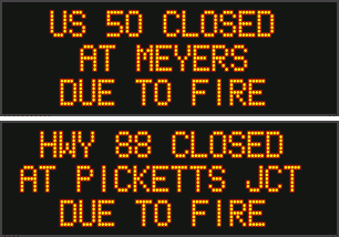
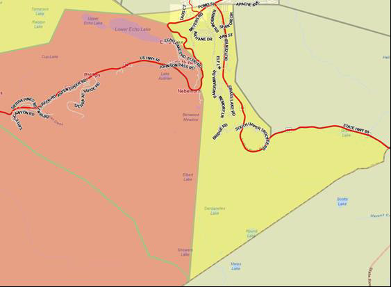
Caldor Fire Evacuations Spread to Alpine County & Closer to Tahoe, Hwy 50 Closure Moved to Meyers |
|
Posted by: thepinetree on 08/26/2021 12:00 PM
|
Grizzly Flats, CA...Update to Evacuation Orders, Warnings, and Road Closures is Effective Immediately for El Dorado and Alpine Counties Road Closures: The Highway 50 closure has been extended East to Meyers (Highway 50 and Highway 89 junction). Evacuation Routes: Residents evacuating the area should use Highway 50 East. Evacuation Order: El Dorado County From Twin Bridges east to Echo Summit , From Highway 50 South to Amador/Alpine County line , From Highway 50 North to Flag Pole Peak.
 |
|
Read More
| 15 Comments
|
|
|
|
|


