Posted by: thepinetree on 09/15/2015 09:03 AM
Updated by: thepinetree on 09/15/2015 05:19 PM
Expires: 01/01/2020 12:00 AM
:

Butte Fire Morning Update...71,660 Acres, 37% Contained, 166 Homes & 116 Outbuildings Destroyed, 4,668 Personnel
Angels Camp, CA....We attended the Butte Fire Action Plan meeting this morning at Frogtown. It is impressive to see the coordination and planning it takes to keep almost 5,000 people attached to this fire working towards the common goal of putting the Butte Fire into the history books. It was inspiring and also gut wrenching to see the sorrow lined faces of some of our local fire personnel who have seen homes of friends, family, co-workers and is some cases their own homes burn. We spoke with Central Fire Chief Jeff Stone where 7 members of the Central Fire Department lost their homes..
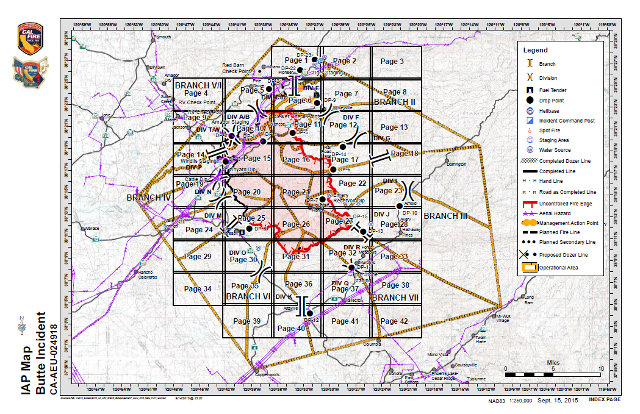


Photos Above From Frogtown This Morning. In two of the above photos you can see a Central Fire Shirt where that Fire District's Firefighters lost 7 homes . Also above is a link to today's map
| Last Updated: |
September 15, 2015 7:15 am |
|
| Date/Time Started: |
September 9, 2015 2:26 pm |
| Administrative Unit: |
CAL FIRE Amador - El Dorado Unit |
| County: |
Amador & Calaveras Counties |
| Location: |
east of Jackson |
| Acres Burned - Containment: |
71,660 acres - 37% contained |
| Structures Threatened: |
6,400 |
| Structures Destroyed: |
166 residences, 116 outbuildings, 12 structures damaged |
| Evacuations: |
Evacuations:
(Amador County) Canyon View, Fig Tree Lane, and Ponderosa Way; Tabeau Road south of Arrowhead to Amador Road, Ranch Drive and Aqueduct Grove Road.
(Calaveras County) West Murray Creek/Murraydale Lane (entire street). All areas east from Mountain Ranch Rd at Calaveritas Rd south to Fricot City Rd, Calaveritas Rd (the east side of Calaveritas), Costa Rd south to Fourth Crossing to Hwy 49 (southeast side). East side of Hwy 49 at Fourth Crossing, south to Cosgrove (Cosgrove is not evacuated but is under an advisory). All areas north from Dogtown Rd at French Gulch Creek east to San Domingo Rd to Sheep Ranch Rd. The areas north along Sheep Ranch Rd at Avery Sheep Ranch to intersedction of Morris Rd/Valley View Rd.
Hwy 26 in Mokelumne Hill at Italian Vista to West Point all areas to include Glencoe, Wespoint and Wilseyville, Bald Mountain Rd, Winton Rd, Blue Mountain Rd, Mitchell Mill Rd, Skunk Hollow Rd.
The entire areas of Railroad Flat Mountain Ranch and Sheep Ranch to include all outlying areas east of these towns. Summit Level Rd, Swiss Ranch Rd, Armstrong Rd and Scott Rd.
Evacuations Advisory:
(Amador County) Hwy 88 from Ranch Road East to Tiger Creek Road (Red Corral and Buckhorn Areas).
(Calaveras County) The corridor along Hwy 49 from the Amador County Line south to the city limits of Angels Camp and all areas east of Hwy 49 that were previously released are now under an advisory. The areas southeast of Calaveritas Road to Costa Road. The areas along Fricot City Road along the southside to Sheep Ranch Road. The areas South of Avery Sheep Ranch Road to Morris Road in Avery. The town of Murphys, Forrest Meadows, Avery and along the Hwy 4 corridor from Avery to Arnold, including the town of Arnold.
Evacuation Centers:
Jackson Rancheria Hotel, 12222 New York Ranch Road, Jackson
Jenny Lind Veterans Hall, 189 Pine Street, Valley Springs, CA
Good Samaritan Church, 4684 Baldwin Street, Valley Springs
Burson Full Gospel Church, 3201 Hwy 12, Burson
Glory Bound Fellowship, 3061 Hwy 12, Burson
Church of Christ, 703 Paloma Rd, Valley Springs, CA
Large Animal Pet Shelters: (Calaveras) Calaveras County Fairgrounds (Amador) Amador County Fairgrounds, contact Kelly Reason at 530-503-5233 |
| Road Closures : |
See Conditions |
| Cooperating Agencies: |
BLM, Cal OES, PG&E, Amador County Sheriff, Calaveras County Sheriff, CHP, Amador Fire Protection District, Calaveras PUD, CDCR, Sutter Creek Fire Department, CAL-TRANS, State Parks |
| Total Fire Personnel: |
4,668 |
| Total Fire Engines: |
516 |
| Total Fire crews: |
82 |
| Total Airtankers: |
8 |
| Total Helicopters: |
18 |
| Total Dozers: |
117 |
| Total Water Tenders: |
58 |
| Long/Lat: |
-120.70418, 38.32974 |
| Conditions: |
Fire behavior remained moderate throughout the day moving southeast allowing crews to be more effective in perimeter control. Firefighters continue to fight the fire aggressively but critical fuel moisture levels, steep terrain, and limited fire access continue to provide challenges. ***Damage Assessment teams have arrived and started evaluations of damaged and destroyed structures*** Road Closures:(Amador County) Clinton Road at Butte Mountain Road (Both Ends) Butte Mountain Road Cutoff at Clinton Road. Amador Lane at Clinton Road, Electra at SR 49, Ponderosa Road at Tabeau, Access to Lake Tabeau is closed; Aqueduct Grove Road at Hwy 88, SR 26 South of Hwy 88.
(Calaveras County) SR 26 from Mokelumne Hill to Ridge Road; Ridge Road closed to Railroad Flat Road; Railroad Flat Road closed to Mountain Ranch Road; Mountain Ranch Road closed to Hwy 49; Michel Road is closed.
RE-POPULATION PHASE I
All residences on East Clinton Road, to Clinton Road
Residences on Irish Town Road and Clinton Road to East Clinton Road
All residences on Mount Zion/Lookout Road area
All residences on Tabeau Road from Hwy 88 to South of Arrowhead
All residences on Clinton Road from Amador Lane/Tabeau Road to East/West Clinton split
For more information on Re-Population visit the following link: Re-Population News Release Sunday, September 13, 2015 at 4pm
RE-POPULATION PHASE II
Additional Evacuations have been lifted and are open to RESIDENTS ONLY: For a list of the applicable roads please visit the attached link
RePopulation News Release Phase II:Re-Population Sunday, September 13 at 9pm
RePopulation News Release Phase III:Re-Population Monday, September 14 at 10pm
If you are interested in making Donations please check out the following link: More Information |
| Phone Numbers |
(530) 647-5218 (Fire Information Line) |
| Phone Numbers |
(209) 754-5527 (Fire Information Line) |
|


